Chapter II
Ginger 'Facts' | Hiking & Backpacking | Snowboarding | Winter Adventures | Weather Home | Behind the Ginger |
|---|
| Date: Day length: | 10/28/2013 ~7 hours |
|---|---|
| Hikers: | Tim |
| Elevation Gain: | 3000 ft |
| Total Distance: | 12 mi |
| Elevations: |
|
| Access: |
|
| Map: Trail #: | Green Trails 270 Wonderland |
| Crowds: | Zero! |
| Trail Conditions: |
|
| Weather: | Blue Bird sunny |
This hike today inspired me to start writing trip reviews again... I haven't been good about keeping notes nor reporting (see last 15 hikes). Hope I can stay on track again.
Today I went up to Summerland and on to Panhandle Gap. I had hoped to make it up before the Sunrise road closed for the year, I read a trip report on this trail for the 26th and hoped that the road would be open till the end of the month. This wasn't the case, luckily I had planned for this and brought a bike; so the 4.5 mi between the 410 turn off (gate) and the trail head were a breeze. In the morning it was a frigid breeze, the only other people I saw the whole day were two bicyclists getting ready to ride the road, they informed me that the air temp of our arrival was 34 degrees :) wish I had brought some windproof gloves for that bike ride.
The upside to the chilly morning was a spectacular clear day, with that fall crispness in the air. This combined with zero people made for a great day, snow started at about the Frying Pan creek crossing, the hard freezes for the last week or so made for great walking, there was a dusting of new snow from Saturday that aloud for making footprints but didn't impede traction . This icy snow was great, I have never been so confident in my micro-spike traction before; I am used to slush (above freezing hiking) and dirt showing through with other hikers boot prints and ruts. Never have I had the opportunity to walk on a solid perfectly smooth surface – it was great, allowed me to push farther than I had originally planed.
The good snow conditions were also great for animal tracks- I was convinced I was following bear tracks on the trail, but after a short distance they turned to more wolf/coyote looking which is less cool but still pretty interesting. The tracks went for about a mile, mostly on what I think was the trail, it was fun deciding if I wanted to take the rout of this critter or what I thought best for the terrain. He did for the most part take the easy, rock free but good snow path.
This hike is the first that I have taken my new toy (not totally necessary) on, I got the Guide 10 solar panel & charger, a solar charger has been on my list since I upgraded to a smart-phone (late August) and have been experimenting with hike GPS logs. Today was a test to see how well it works and just play around with it. So far so good, got about half a charge on my phone while it was using GPS with no signal (draining a lot of juice) with about 2 hours of sunlight on snow. I have hopes of one day getting it to where this system can charge phone/camera/flashlight/headlamp for multi-day adventures.
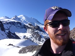
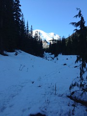
Photos from today: